Researchers from the University of Colorado and the National Oceanic and Atmospheric Administration in Boulder have begun a new study to measure air pollution from oil and gas fields across the West.
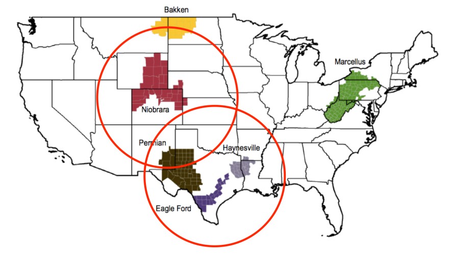
The scientists are flying a small airplane across numerous oil and gas basins, from North Dakota's Bakken oil field, through Wyoming, Colorado, and Utah, and all the way down to Texas. They will take measurements of methane as well as ozone precursors, and aim to answer the question: Why do some oil and natural gas production basins pollute more than others?

Joost de Gouw, a research scientist with NOAA's Earth Systems Laboratory has been involved in past research flights in various basins across the United States from Utah to the Denver Julesberg Basin to the Marcellus Shale, in Pennsylvania. He said results from those flights show that different basins have very different rates of pollution. In parts of Utah, for example, around 8 percent of the total natural gas, or methane, was leaking from oil and gas fields. In the Marcellus Shale, in contrast, the rate was under 1 percent.
"By combining data from all different basins we hope to get a better handle on this variability and how it is controlled. For example by the composition of the oil and natural gas, the production methods, any regulation that the states may have in place," said de Gouw.
There are many factors that could be leading to different rates of pollution, and with these flights, the researchers hope to gain an understanding of why. A different air quality research project with NASA and NOAA took place in 2014, but with three aircraft measuring many different aspects of Front Range air quality.
Methane is a powerful greenhouse gas, and limiting leaks will help prevent even more climate change. Colorado has to do this. Ozone precursors like nitrogen oxides and volatile organic compounds, also emitted from oil and gas fields, can turn into ground level ozone, which hurts human health. Limiting both pollutants would help both human health and the environment.
"All of these things are not very well known at this point and a better understanding will help define more effective policies," said de Gouw.

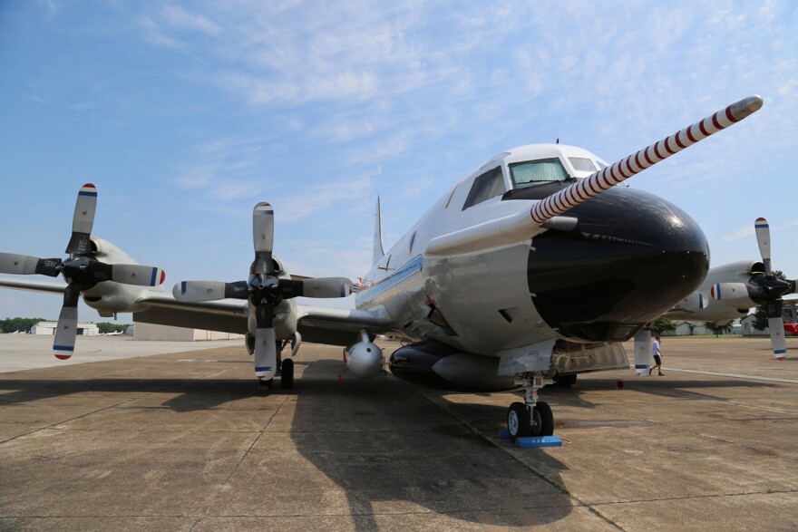
The plane, a P3 equipped with several scientific instruments, will fly around 1500 feet above the ground and be very visible to people in the areas it flies. It takes off from an airport in Broomfield, and the researchers cover one basin at a time. Flights have already occurred over the San Juan Basin, which straddles the Four Corners region.
The plane's tail number is NOAA43 and interested watchers can track it on .


