Hop on Interstate 25 in Denver, drive an hour north and you'll find yourself in the middle of one of the country's fastest-growing regions: Northern Colorado. But where exactly does it start? Where does it end?
Earlier this month, we invited six residents from Fort Collins, Greeley, Evans, Loveland and Wellington to KUNC's offices to help answer that question.
The group consisted of students, longtime residents and a local city councilwoman. We also invited Colorado's state demographer to weigh in.
The assignment: Illustrate where the region starts and ends on a blank map of Colorado.
The findings surprised us. No two maps were the same. Residents had a wide set of opinions on what cities, counties and landmarks formed this part of the state. Culture was also a big factor. So were family ties.
The participants
Ava Guzman, Student, Wellington

Guzman started by marking a few landmarks on the map, including a movie theater in Denver, KUNC's offices in Greeley and her home in Wellington.
She drew a simple orange line to divide north and south.

Blake Coontz, Student, Fort Collins

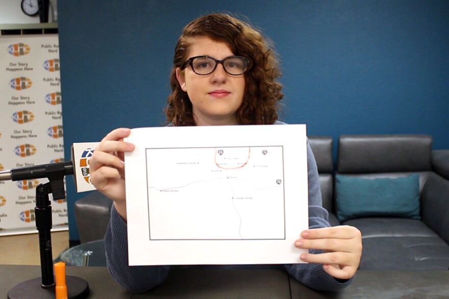
Coontz, a student from Fort Collins, took a similar approach. She started by drawing a dotted line across the state.
She added a few personal touches, including a circle around Steamboat Springs, where her family goes to celebrate Father's Day. Blake also traced her dad's truck route (he's a driver) between Fort Collins, Colorado Springs and Greeley.
Her family went on a road trip to California earlier this year, so she made sure to highlight Interstate 70 (not a part of Northern Colorado) with an orange marker.

Rodney Ley, Assistant director of Campus Recreation at Colorado State University, Fort Collins

Ley's map was the most detailed of the bunch. He started by drawing a red line down the middle of Weld County, which included the area east of Greeley. His southernmost border stopped at the communities of Dacono and Firestone and did not include Longmont or Boulder.
To the west, Ley encircled Estes Park. But he left out nearby public lands, including Rocky Mountain National Park. In his eyes, the western border of Northern Colorado is the border between Larimer and Jackson counties.

Ley also said communities such as Red Feather Lakes and Pierce "would not consider themselves" part of Northern Colorado. He drew small red circles to exclude them.
Areas he shaded in blue, including Boulder and Denver, are places he would not consider to be Northern Colorado.
Kathi Wright, Loveland City Council member, Ward 2, Loveland

Wright said her definition of Northern Colorado is simple: Fort Collins, Loveland, Greeley and the smaller communities in between, like Windsor and Timnath.
"Because we all talk to each other and work together," Wright said. "When we have regional elected officials meetings, those are the (places) that come together."

CristĂłbal (Chris) Garcia, Co-creator of Latino Northern Colorado podcast, Evans

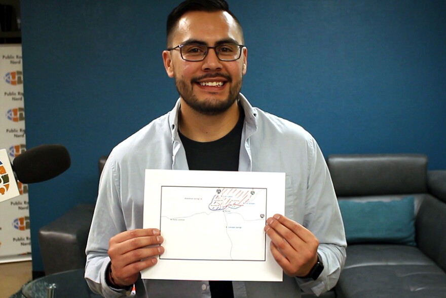
Garcia's map included Fort Collins, Loveland, Greeley, Boulder, Commerce City, Fort Morgan and Brighton.
People living in the smaller area (shaded blue) may or may not not feel like they're a part of Northern Colorado, he said. Same goes for the Commerce City area (shaded green).
"I would add that I think Northern Colorado should include any cities or communities that feel like they are Northern Colorado," Garcia said. "Let's be inclusionary and invite folks to join us as we become a very powerful region in our state."

Kate Stahla, Student, Greeley

Stahla grew up in Loveland and prefaced her drawing with a disclaimer:
"I feel like Northern Colorado is a fancy made up word sometimes," Stahla said. "It's not really a region — it's a mentality."
With that in mind, she drew a simple orange border roughly around Larimer and Weld counties.
"It goes all the way up to the Wyoming border because it's the north of Colorado," she said. "But it's not North Colorado. That's a different thing."

Elizabeth Garner, Colorado state demographer, Denver

The state demographer's office puts together population forecasts for cities and regions across the state. So, we asked Garner to be our resident geography expert.
Her office defines Northern Colorado as simply Larimer and Weld counties. That's because of the population data available.
"I know a lot of people are much more interested in cities than they are in counties," Garner said. "But counties have the best level of data."
First, she looked at each guest's drawing and assessed its "accuracy." She picked Rodney Ley's detailed drawing as her favorite.
"Just because I like detail," Garner said. "It was pretty clear and tried to define inside and outside."
Then, she drew her own.

Garner said "about 600,000 people" are expected to move either to Larimer or Weld County between now and 2050. The estimate is based on estimated job growth. By 2025, Weld's population will surpass Larimer's in size, she added.
There's also enough physical space to grow.
"Weld is a big county and it's got a lot of area," she said. "It's got transportation corridors and there's a lot of leadership that's been looking at where Weld County fits into the big picture."
Garner's big takeaway from the experiment was that it's "really, really" important to think about the language we use to define parts of the state.
A lot of discussions are happening around the region's future transportation, water and infrastructure demands. And they need to be well informed, she said.
"When I say Northern Colorado, I know exactly what I'm talking about," Garner said. "But knowing that other people define it differently has been a good lesson. It's something we could easily spend more time talking or thinking about."


