Last updated at 11:50 a.m. on 9/11/2020
Daily maps, photos and reports on the size and containment of active wildfires in Colorado. This is a developing story — check back for updates.
Active fires at a glance
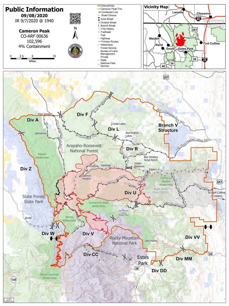
- Cameron Peak Fire: 102,596 acres, 4% containment
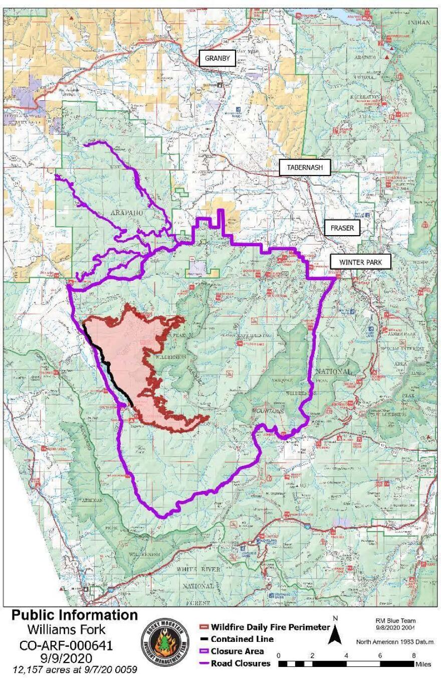
- Williams Fork Fire: 12,157 acres, 10% containment
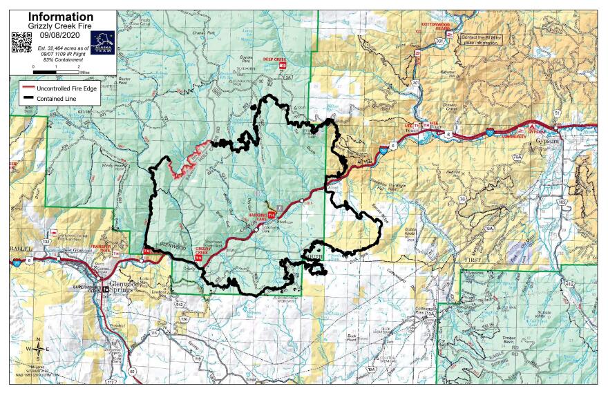
- Grizzly Creek Fire: 32,431 acres, 91% containment
- Pine Gulch Fire: 139,007 acres, 95% containment
- Middle Fork Fire: 3,522 acres, 0% containment
- Goose Creek Fire: 171 acres, 85% containment
__
__
Northern Colorado evacuation orders, road closures
__
Cameron Peak Fire
Started: Aug. 13, 2020
Cause: Unknown, under investigation

Rocky Mountain Incident Management Team
__
Williams Fork Fire
Started: Aug. 14, 2020
Cause: Human-caused

Great Basin National Incident Management Team
__
Grizzly Creek Fire
Started: Aug. 10, 2020
Cause: Unknown

Great Basin National Incident Management Team
__
Pine Gulch Fire
Started: Jul. 31, 2020
Cause: Lightning

Rocky Mountain Incident Management Team
__
More resources and updates


